Travel Information
Traveling by car to Puerto Peñasco, also known as Rocky Point, is the most accessible way to reach this treasure on the Sea of Cortez. Be sure to review travel information as you plan the perfect beach getaway just across the US/Mexico border.
Travel Information to Rocky Point
Rocky Point is in the northwest corner of the Mexican state of Sonora on Mexican Highway #8. It is just 1 hour (about 65 miles) from the Lukeville, AZ/ Plutarco Elias Calles (Sonoyta) border crossing. It is important to note the Lukeville/Sonoyta border entry is open currently from 6 a.m. – 8 p.m. Lukeville/Sonoyta port of entry hours may be extended at times* (*Extended FRIDAY hours till 10 p.m., March 7 thru Oct 10, 2025). Be sure to confirm with Casago’s reservation stewards for more information.
Driving from Arizona
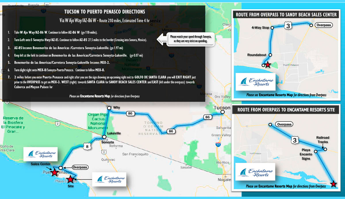
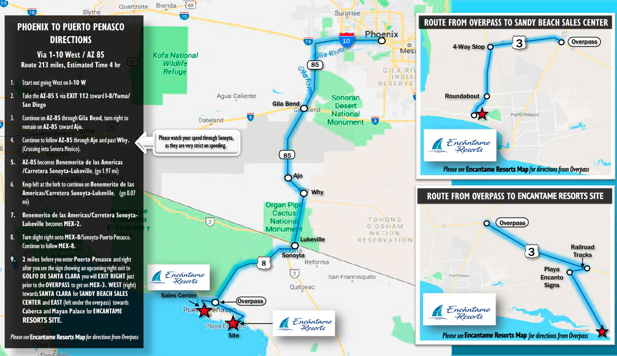
Rocky Point is frequently called “Arizona’s beach” given its proximity to its northern neighbor. Driving time from either Phoenix or Tucson is approximately 3½- 4 hours. Whether you take I-10 from the Phoenix metropolitan area or AZ highway 86 from Tucson, you will meet up with AZ Highway 85 south to the border crossing in Lukeville.
Driving from California
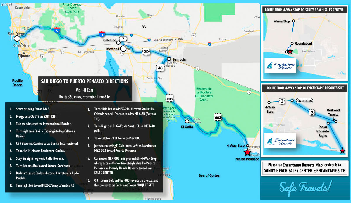
From California, you may choose to take I-10 to Gila Bend, AZ and then AZ Highway 85 to continue to travel on highways in the U.S. Another option in Mexico is MX Highway #2 from San Luis Rio Colorado to Sonoyta, or the “Coastal Highway” from San Luis Rio Colorado to Puerto Peñasco. This includes a short toll-road. Please note: The Coastal Highway may present drifting sand and other road damage due to erosion (including pot holes).
Travel Information to Rocky Point: Maps


